News
An Icy Start to 2021: Winter Weather Advisories for Freezing Rain Issued
By: Nicholas Snider
Posted on:
ATHENS, OH (WOUB)—Another winter system will begin working its way through southeast Ohio Thursday night into Friday morning.
The National Weather Service in has issued a Winter Weather Advisory for Washington, Athens, Perry, Morgan, Jackson, Vinton, Fairfield, Hocking, Licking, Pike, Ross, Pickaway, and Franklin counties until 10:00 AM Friday.
Be sure to have multiple ways to receive weather updates over the next 24 to 48 hours.
A warm front associated with this system will begin moving north late this evening.
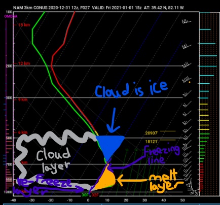
As the warmer air moves up into our area, it will begin rising above cooler, denser air at the surface. As upward motion is generated to produce clouds, cool air aloft will allow moisture in the atmosphere to become mainly ice crystals in the upper levels.
As these ice crystals begin to fall, they will encounter the warmer layer of air and melt. This air will likely stay above freezing until just before the surface. At the surface, with temperatures at or below freezing, the water will freeze on contact once it lands.
Freezing rain will be quite brief across our forecast area.
Precipitation will move in around 6 am Friday and fall in the form of freezing rain.
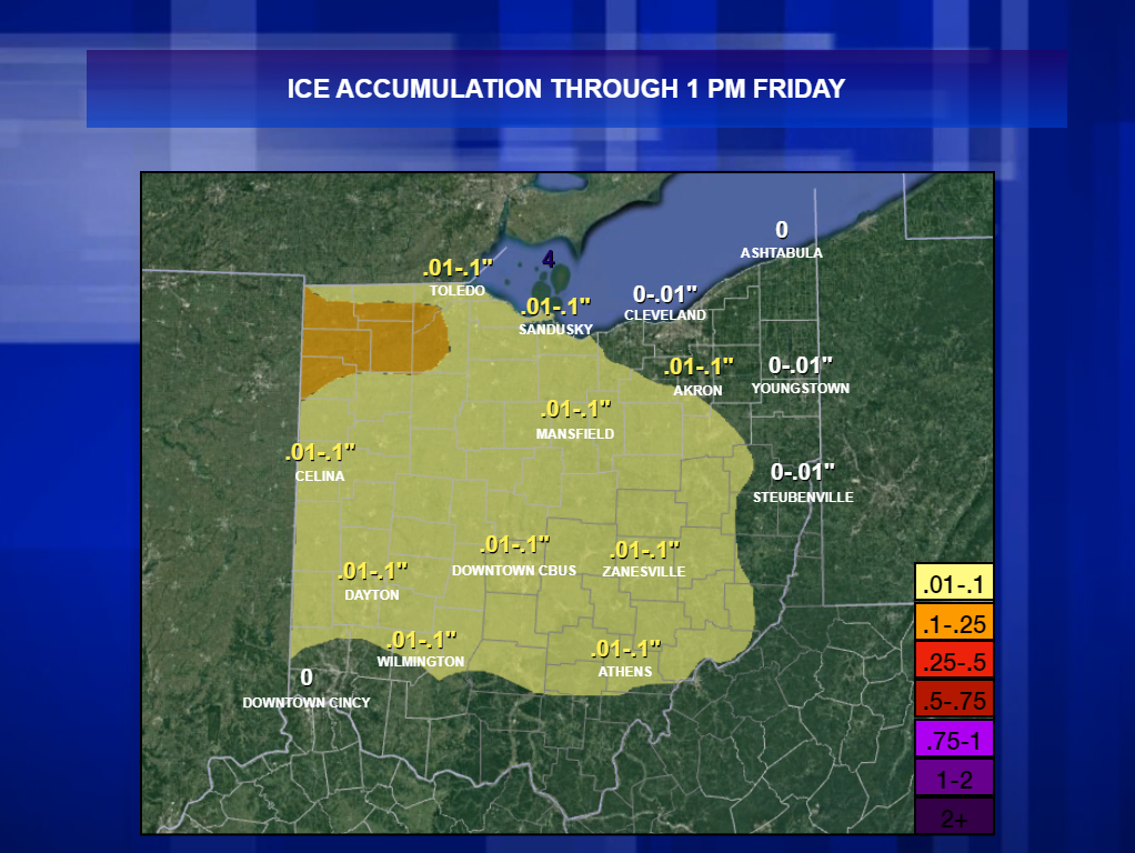
Further north and west, freezing rain will last a few hours longer, making ice accumulation a bit more likely in Fairfield, Hocking, Franklin, and Licking counties. Elsewhere, expect only about an hour of freezing rain before precipitation changes to all rain. Below are forecast ice accumulations through 1 PM Friday.