News

Don’t Cut Those Trees — Big Food Might Be Watching
By: Dan Charles | NPR
Posted on:
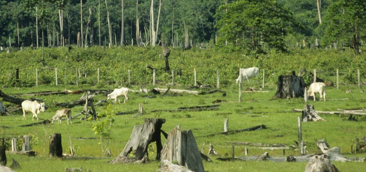
Brazilian scientists are reporting a sharp increase this year in the clearing of forests in the Amazon. That’s bad news for endangered ecosystems, as well as the world’s climate. Deforestation releases large amounts of heat-trapping carbon dioxide.
It’s also a setback for big food companies that have pledged to preserve those forests — or at least to boycott suppliers that clear forests in order to raise crops or graze cattle. “Traders such as Cargill, Bunge, or Louis Dreyfus; consumer good manufacturers such as Mondelēz or Procter & Gamble or Unilever; retailers such as Walmart and McDonald’s — all the major brands have made those commitments,” says Luiz Amaral, director of global solutions for commodities and finance at the World Resources Institute.
Most of the companies promised to cut all links to deforestation by 2020, but few are likely to make that deadline. Turns out, it’s really hard for companies to ensure that none of their raw materials came from recently cleared land.
So Amaral and his colleagues just created a new online tool for companies to use. They call it Global Forest Watch Pro.
Amaral works in Brazil. I’m in Washington, D.C. But with the magic of computer screen-sharing, he can show me exactly how it works.
Amaral pulls up an image of the globe. This particular image shows which areas are covered by trees. Amaral calls it “the Google Maps of forests.”
This map is created from data collected by satellites operated by NASA. One satellite scans the entire planet every week, constantly updating this map.
So it’s possible to tell whether trees disappear from one week to the next. Another satellite monitors the entire globe for fires.
Researchers at the University of Maryland created software to filter this flood of data and detect the signals of deforestation. “The key innovation here is that the computer is doing all that work for us, constantly looking at those images as they’re being taken, to identify if something changed in the tree cover; if there is a fire in that area,” Amaral says.
Then Amaral shows me how to use this tool to monitor specific farms. “I uploaded 22 cattle farms in Brazil,” he says. These farms show up as highlighted areas in one region of Brazil.
These are real farms. Amaral got their information from a public database of land ownership in Brazil. With a few mouse clicks, we see how much of each farm is covered with trees and how that area has changed.
He points out one 40,000-acre-farm. Half of it is covered in forests. But we can also see that, 15 years ago, the whole thing was forest. We zoom in closer. We can see exactly where trees disappeared in this part of Brazil.
“So you can see here that almost all the tree cover loss within this region actually happened within this specific farm here,” he says.
The boundary of this farm, in fact, lines up almost exactly with the area of deforestation. It looks like intentional forest-clearing, not a wildfire.
“That would be exactly my assumption,” Amaral says.
In a similar way, a food company can enter the locations of farms from which it buys raw materials. Global Forest Watch Pro then will send an alert whenever it detects deforestation within that area.
The company Mondelēz International, which makes Oreo cookies and Triscuit crackers, already is using it. “I think it’s actually extremely important,” says Jonathan Horrell, the company’s director of global sustainability. “The tool enables you to understand what’s actually happening in real time.”
Mondelēz has pledged to cut its greenhouse emissions. But when it did an audit of those emissions, it realized that fuel-burning factories and trucks were not the biggest part of its carbon footprint. “It’s actually the carbon emissions that are linked to deforestation — forests being cut down in order to produce raw materials that we use in our products,” he says.
Those raw materials include palm oil from plantations in Indonesia, and cocoa farms in West Africa.
Companies that want to use Global Forest Watch Pro have to figure out exactly where their suppliers are, and that can be difficult.
Mondelēz is doing this with cocoa farms. “As of the end of 2018, we’d mapped 90,000 farms in Ghana and Côte d’Ivoire, which are the most important sources of cocoa in our supply chain,” he says. Mondelēz and other companies also monitor land that’s close to mills where they buy palm oil.
This is easier to do when companies buy food directly from local producers, as is often the case with cocoa and palm oil. In other cases, though, products move through a long chain of intermediary companies. Farmers who raise cattle may sell them to a local slaughterhouse, not directly to McDonald’s.
Yet Luiz Amaral, from the World Resources Institute, says even local slaughterhouses can use this new online tool. The beauty of this tool, he says, is that it’s so cheap and easy to use. In fact, WRI has persuaded one slaughterhouse in Paraguay to sign up for an account.
9(MDI4ODU1ODA1MDE0ODA3MTMyMDY2MTJiNQ000))

