
News
December 2019 vs December 2020: A Tale of 2 Weather Years
By: Nicholas Snider
Posted on:
ATHENS, Ohio (WOUB) — 0.1” of snow. That is how much snow Parkersburg, WV, the nearest climate reporting station, saw in the month of December in 2019. This year tells a much different story. So far in December 2020, we have already seen over 3 inches above our climatological average in snowfall, sitting at 14.1”. The pattern has overall been much cooler and stormier than last year. There are many factors that can contribute to this.
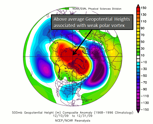
The Arctic Oscillation (AO) is one of the most influential patterns that affects weather across the eastern third of the continental United States. This describes how pressure patterns behave over the Arctic Circle. When there is broadly lower than normal pressure over the Arctic, higher pressure will migrate down into our region, the midlatitudes along the eastern third of the continent. This is known as a positive Arctic Oscillation phase. With generally higher pressure over the midlatitudes, warmer than normal temperatures and calmer weather will spread into the eastern third of the country.
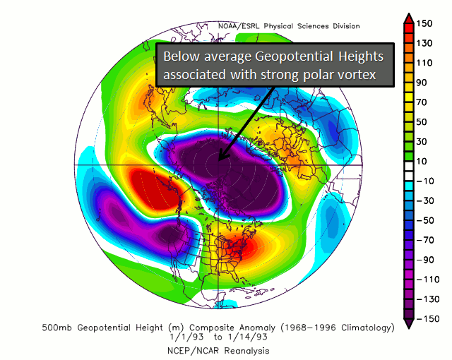
A negative Arctic Oscillation phase brings the opposite, with broadly higher pressure over the arctic, and lower pressure over the midlatitudes across the eastern third of the continent.
This means cooler than normal, and stormier than normal weather for the midlatitudes, with warmer than normal temperatures and calmer weather for the Arctic, and western third of the continent.
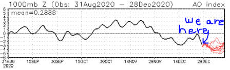
Looking at climate data from the Climate Prediction Center, the Arctic Oscillation has remained in its negative phase through much of this winter, in contrast to last winter.
Another factor into the cooler/snowier pattern so far has been the Pacific North American Oscillation, or PNA. Like the AO, the PNA describes broad locations of higher-than-normal pressure and lower-than-normal pressure—this time over the west coast of North America. During a positive phase of the PNA, higher pressures will generally be focused over the western half of the US, with lower pressures in the eastern half. This leads to a cooler and stormier pattern across the eastern US, and a warmer, calmer pattern out west. A negative phase of the PNA leads to the opposite occurring, with higher pressures over the east, and lower pressures over the west.

This leads to cooler/stormier weather out west, and warmer/calmer over the east. A slightly positive PNA this year compared to a slightly negative PNA last year made a difference, along with the Arctic Oscillation.

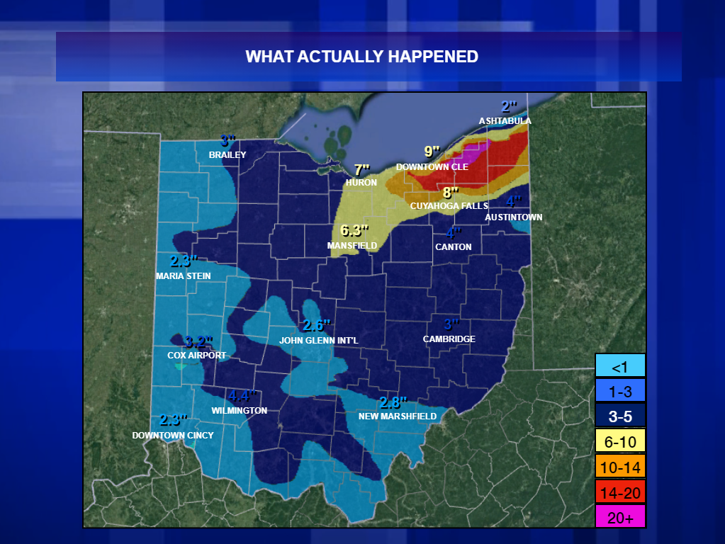
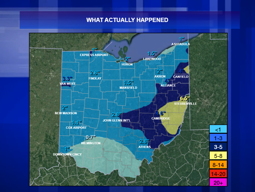
Because of these two important factors, multiple systems have made their way through the forecast area this December. The three most prominent systems were December 1, December 16, and December 24/25. Each of these events dropped at least 2 inches of snow across much of southeast Ohio.

The stormy pattern is expected to carry over into January. Model trends continue to point toward a negative AO lasting through at least the first two weeks of January. The PNA becomes a bit trickier, as guidance is trending neutral/negative through the first two weeks of January. This makes sense, given La Nina years tend to favor negative PNA phases. This would likely result in a more east/west storm track across southeast Ohio, favoring slightly above average temperatures, and precipitation. All in all, however, this winter has proven it will not be a repeat of the virtually snowless 2019-2020 winter.