
News
Weekly Weather: A Fairly Dry, But Gloomy Pattern
By: Nicholas Snider
Posted on:
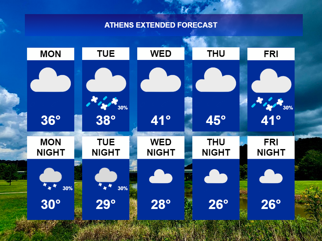
ATHENS, OH (WOUB)– Mainly cloudy skies and near average temperatures. Those will be the weather headlines across southeast Ohio over the next 5 days or so. There are a few disturbances that may stir up some precipitation, but this will have very low impacts on the overall region.
Early Week (Monday through Tuesday)
The jet stream looks very disorganized over our area, keeping arctic air bottled up to the north, but unseasonably warm temperatures off to the south
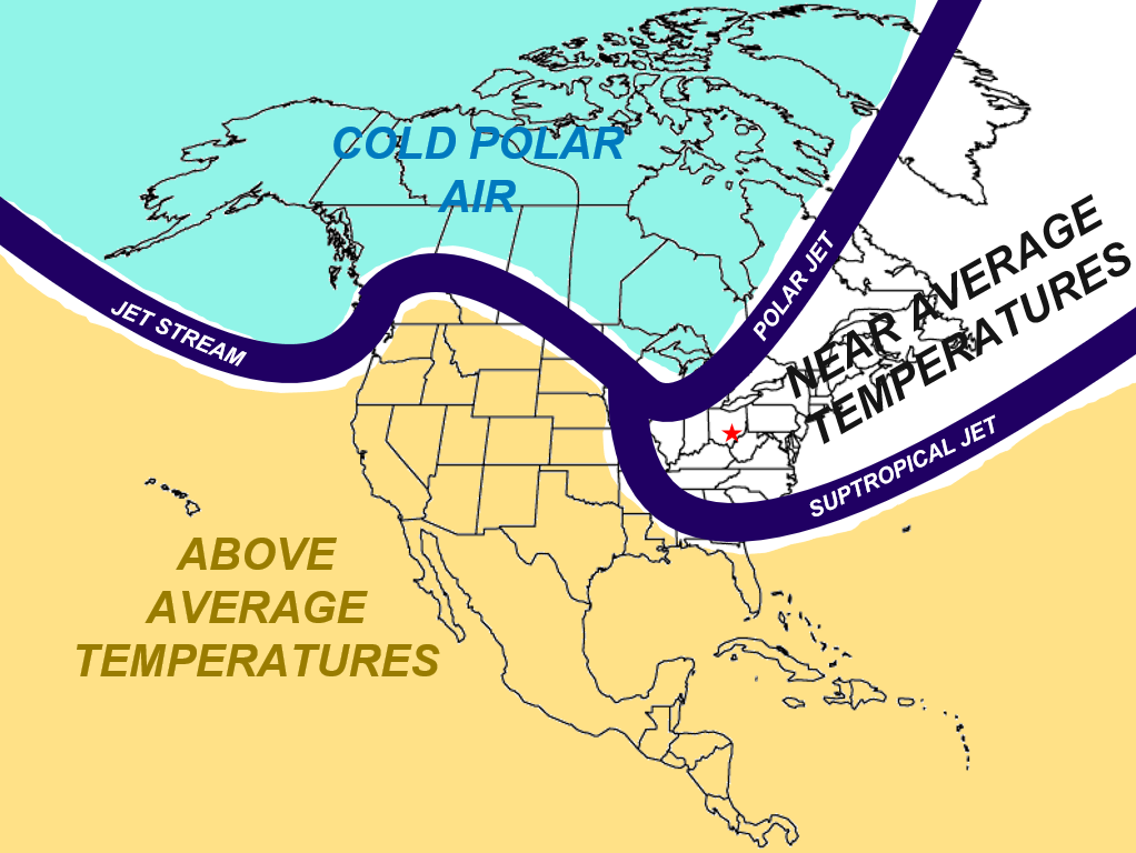
For the early week, cresting in the main jet stream will remain off to the west, keeping very warm temperatures out there. Over the eastern Plains, the jet stream will split into two branches: the polar jet and the subtropical jet. Wedged in between the two branches, near average temperatures (in the upper 30s and lower 40s) will persist.
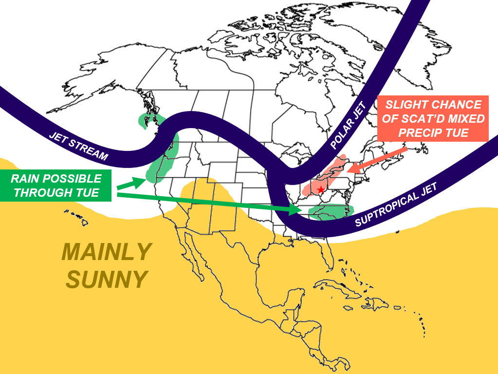
Downwind of the dip in the polar jet stream, weak upward motion will generate widely scattered and light mixed precipitation Monday night through Tuesday evening. Snow will be the main precipitation type during the nighttime hours, with rain mixing in during the day. Little to no snow accumulations will be expected, as this precipitation will be widely scattered. After this precipitation clears out, expect mainly cloudy skies for the remainder of the early-week.
Late Week (Wednesday through Friday)
While the jet stream will have some variability, a fairly similar pattern will set itself up during the latter portion of the week.
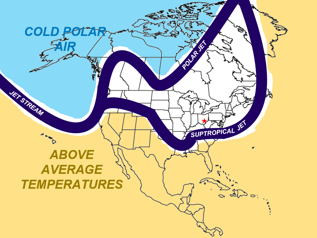
All of southeastern Ohio, northern West Virginia, and northeastern Kentucky will remain under the split pattern, with very cold air bottled up north, and very warm air kept down south. However, better chances for precipitation will come Friday for the far southern portion of the viewing area.
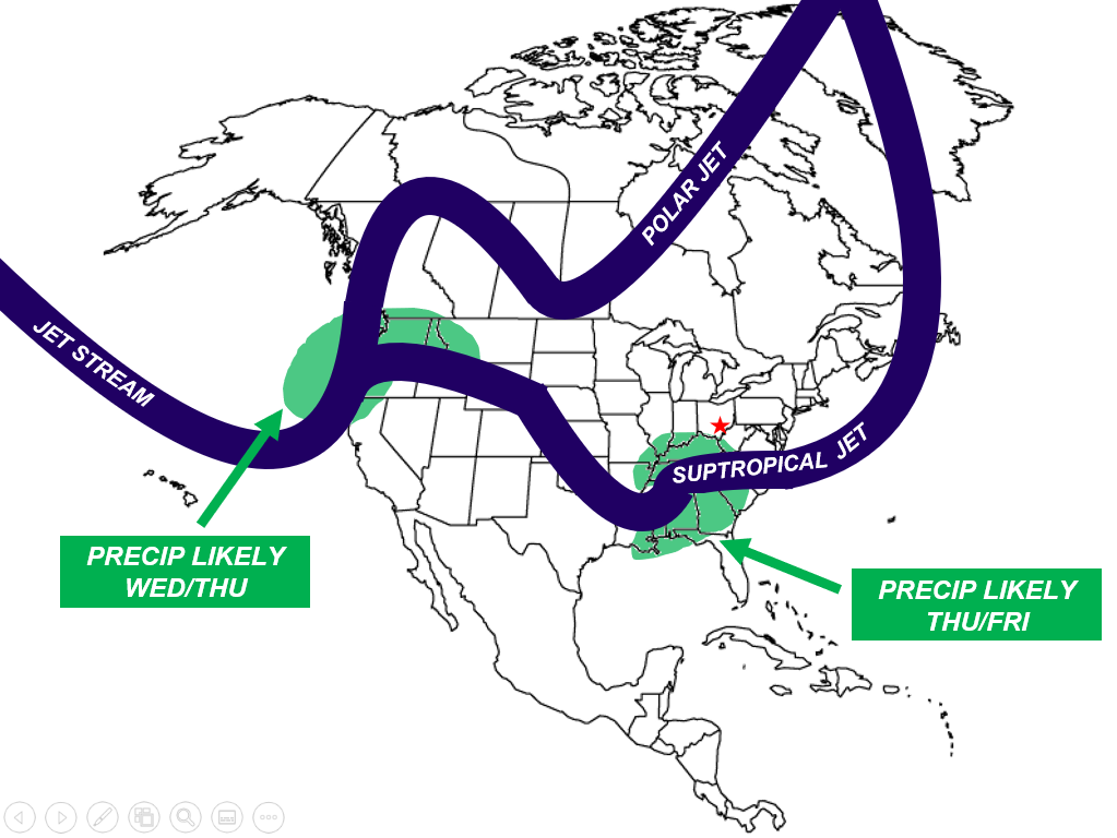
A slight dip in the subtropical jet stream will allow an area of low pressure to form near the Gulf of Mexico. This dip will move in an east-northeasterly direction, and bring rain and possible snow to portions of Kentucky and West Virginia Late Thursday night into Friday. There is still great uncertainty with the northern extent of precipitation at this time. Some light snow accumulation could be possible across far southern counties in Kentucky and West Virginia. Stay tuned for more details. A potent dip in the jet stream off the west coast will also drive precipitation Wednesday and Thursday across northern California, Washington, Oregon, and Idaho. If traveling to this area, expect some delays.
Summary
All in all, nothing unseasonable or hazardous should be expected across southeastern Ohio, northern West Virginia, and northeastern Kentucky for this coming week. Expect mainly cloudy skies, highs in the upper 30s/lower 40s, and a few bouts of light snow showers with rain mixing in during the day.
This article covers very general meteorological concepts. For a detailed technical forecast, please visit the Scalia Laboratory’s Technical Discussion page