
News
How scientists lasered in on a ‘monumental’ Maya city — with actual lasers
By: Emily Olson | NPR
Posted on:
It’s not every day that modern researchers uncover an ancient lost city.
But for a network of scientists exploring Mexico’s central Yucatan Peninsula, that very phenomenon is becoming so common that it’s become the butt of a joke.
“If you get a map of the state of Campeche and you throw a dart at it — well, where the dart hits, there’ll be a Maya settlement,” explained Juan Carlos Fernandez-Diaz, an assistant professor at the University of Houston.
For decades, archaeologists thought this area’s ultra dense and fairly dry landscape would’ve been too harsh to sustain early settlements of the Maya civilization — the culturally sophisticated Mesoamerican society that dominated the region from roughly 250 B.C.E. to 900 C.E.
The Maya people never truly disappeared; the descendants of the ancient civilization still live throughout Central America. But a combination of catastrophic events caused many to abandon their homes and towns thousands of years ago, leaving ruins to be uncovered centuries later.
Those ruins were thought to be concentrated in what is modern day southern Mexico, Guatemala, Belize, Honduras and El Salvador.
But assumptions about the Maya’s range are being quickly eroded thanks to light-mapping technology, lasers that can help identify shapes and structures along the jungle’s floor.
This May, a field team visiting one of those mapped sites in the Yucatan discovered what was once unthinkable: a previously unknown and massive Maya city that may have served as a political center in the region.
Already, the so-called city of Ocomtun is causing archaeologists to question what they thought they knew about the ancient Maya — and what kind of lessons the civilization can offer today’s metropolises.
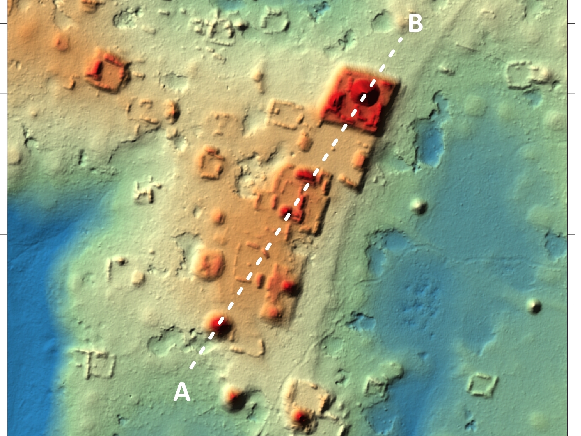
Lidar technology helps scientists laser in on miles and miles of jungle
In the 19th and 20th centuries, archeologists uncovered Maya ruins with the help of local populations or even by accident, such as the time the botanist Cyrus Lundell identified the pyramids of Calakmul from the window of an airplane.
But these days, the process is a lot more intentional, if also a little less glamorous.
Researchers begin by analyzing aerial imagery from places such as Google Earth. Even with that big-picture data, the teams working to uncover Ocomtun could spot artificial shapes in the area’s greenery — a raised circle in the vegetation here, a suspiciously rectangular reservoir there — that gave them hopes of finding new settlements.

Fernandez-Diaz describes lidar as “playing racquetball against a wall” — but if the racquetball was light, the wall was the jungle floor and the racquet was an airplane, flying in tidy rows above a dense canopy.
Collecting data on Ocomtun required three four-hour flights. Each time, the plane’s equipment poured down billions of laser points (about half a million pulses per second).
It was not until hours later, back in the lab, that the team can start to visually strip away the trees in an act of digital deforestation, revealing the human-made structures underneath.
Meet the ‘real-life Indiana Jones’
“The way I see it, we’re like ultrasound techs,” Fernandez-Diaz said. “We’re the ones performing the tests, we’re the ones creating the image, and we’re the first ones to see the baby. But that baby’s not ours.”
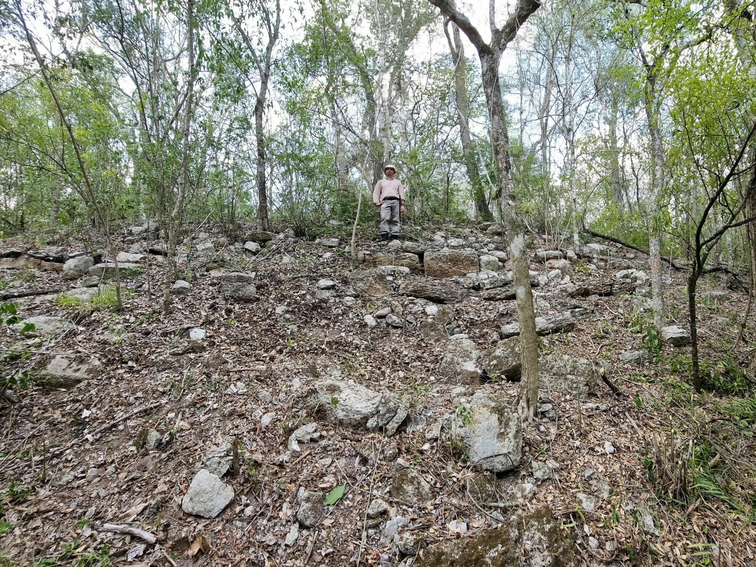
That’s because once a site is mapped, it still has to be verified the old fashioned way: in the field, on foot.
This is where Dr. Ivan Sprajc comes in. Working under the Slovenian Academy of Sciences and Arts and alongside Mexico’s National Institute for Anthropology and History, Sprajc has had so much success in pairing these mapped sites with actual findings that his colleagues refer to him as “the real-life Indiana Jones.”
What others might see as a formidable challenge of terrain only excites Sprajc.
The only routes into the area are old hunting and logging routes, which Sprajc describes as “densely overgrown.”
Even using those old trails as a guide, it took Sprajc’s small crew, carrying supplies and wielding chainsaws, about two weeks to traverse the 30 miles from the nearest road.
“When the trail was completely clean, in the best of conditions, it took us five hours to get from our camp to Ocomtun,” he said. “If trees fell, if it rained, it could take as long as 10 hours.”
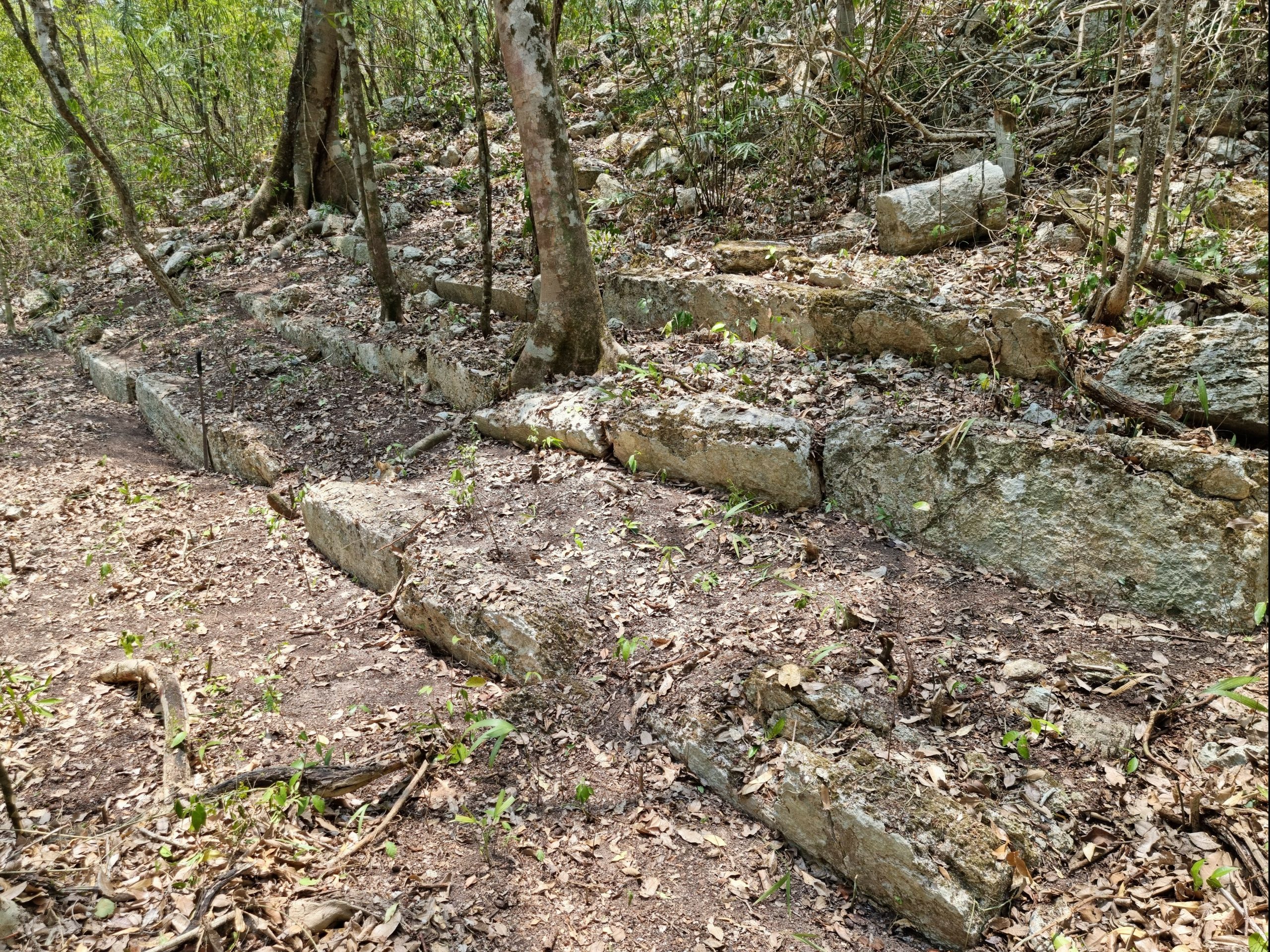
Ocomtun contains ‘monumental’ structures and puzzling shapes
But the trek was worth it. Archaeologists who weren’t involved in the discovery agree that Ocomtun is special, in part, because of the size and quantity of structures.
There are “several architectural complexes that we would call monumental, requiring hundreds of laborers quarrying and moving thousands of tons of stone by hand over multiple decades,” said Scott Hutson of the University of Kentucky.
One structure, which Sprajc is calling an “acropolis,” stretches about 80 meters long and rises over 25 meters tall. Another low platform of concentric circles and squares, may have housed a marketplace or cultural ceremonies.
Like these columns, many of the structures at Ocomtun appear consistent with the late Classic period, between the years of 600 and 900 C.E.
But some objects, like fragments of ceramics, appear to date even earlier, around 1,000 B.C.E.. If that timeline is correct, it could make Ocomtun one of the earliest sites in the central Maya lowlands, Sprajc said.
At the same time, Sprajc and his team uncovered “strange, irregular mounds” on top of the acropolis-type structure, which contained figurines characteristic with later periods, which might have been placed there as offerings to earlier generations.
It’s a sign the post-classic settlers may have remained in Ocomtun later than other Maya civilizations, possibly right up to Spanish conquest in the 16th century.
In other words, Ocomtun didn’t just exist; it endured. But how?
Could the keys to survival lie deep in the jungle?
Maybe just as important as what the team found in the center of Ocomtun is the size of the area around the city.
All along the route to the site, Sprajc’s team spied mounds and piles of stone, the telltale remains of old dwellings. It’s a bit like driving through the suburbs to get to the city. The density of those smaller settlements is good evidence that Ocomtun was an important trade or cultural center.
And it all adds up to compelling evidence that Ocontum’s settlers achieved population growth against the odds.
Scientists already had to revise their estimates of the Maya population in 2018, following a round of lidar mapping work in Guatemala. But now it looks like those initial estimates of 11 million may need to be raised again.
And tucked into the piles of stone deep in the heart of Ocomtun, between the flowering ferns and swaying palms, there may be lessons on how to sustain life in the face of climatic peril.
These Maya settlers were able to survive, without much technology, in a region where coarse limestone keeps water stored deep underground and streams dry up every summer.
“This is something that we now turn our attention to: Exactly how did they do that?” Martin said.
‘It’s not what you find; it’s what you find out’
There’s a third step to the process of modern Maya discovery: Excavation.
It may be years, even decades, until yet another team of researchers can come in and properly unearth Ocomtun’s secrets — a step that requires even more logistical coordination and approval from the Mexican government.
As for Fernandez-Diaz and Sprajc, they say there’s still more work to be done in the first two phases, with three additional mapped sites that could be confirmed as Maya cities with proper field work in the coming years — if the funding holds.
A single lidar flight — only phase one of the discovery process — can cost thousands of dollars.
The expedition to Ocomtun was funded by a global coalition of corporations (the Slovenian train operator Adria Kombi, financial services group Kreditna družba Ljubljana, and tour operator Al Ars Longa) and charities (Research Center of the Slovenian Academy of Sciences and Arts, Založba Rokus Klett, plus the Ken & Julie Jones Charitable Foundation, and the Milwaukee Audubon Society).
Archeologists agree that the work matters now more than ever. The ancient Maya civilization was never truly lost, but many settlements were abandoned (sometime in the 10th century) due to a combination of warfare, over-population and intense climatic change.
“It’s a combination of stressful factors we’re facing nowadays as well,” Sprajc said. Knowing how and why the Maya endured, or didn’t, could serve as a roadmap for how to endure our current challenges.
It’s that logic that has inspired a second joke in the archeology community — one about the relative futility of finding a site without figuratively and literally digging in deep.
As Fernandez-Diaz put it, “It’s not what you find; it’s what you find out.”
9(MDU1ODUxOTA3MDE2MDQwNjY2NjEyM2Q3ZA000))